
A Masterpiece of Visionary Design
100 Years
of the
Dymaxion
Map
Celebrate With Us
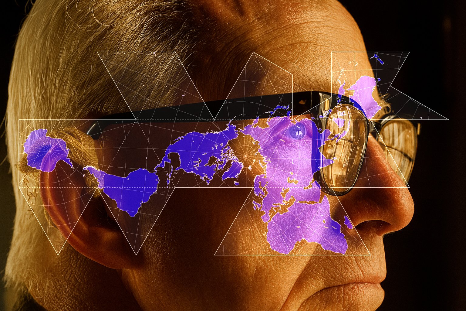
As we approach the 100th anniversary of Buckminster Fuller’s Dymaxion Map—conceived in 1927, patented in 1936 —we honor his genius for re-imagining our planet as one continuous, interconnected island in a single global ocean, the One Earth Island.
The Dymaxion Map breaks traditional boundaries, visually uniting all continents without distortion of scale. It reveals the Earth not as divided nations but as one living system.
Seven dynamic data layers—Watersheds, Human Habitats, Sea Ice, Mountains, Glaciers, and more—tell the story of Earth’s beauty and fragility. Each iteration reminds us: our planet’s future depends on recognizing our shared interdependence.
If you’re interested in hosting a physical installation of the Dymaxion Map at your museum, airport, business, or school, contact us to collaborate. Recent studies by the Airport Council International show that over 68% of travelers feel more connected to their destination when experiencing local art and cultural exhibits—proof that visionary design inspires global understanding.